Crowley’s Ridge Parkway: Travel this National Scenic Byway through the Arkansas Delta Region
Visitors driving through Northeast Arkansas may be astonished to find a ridge rising up in the midst of an otherwise flat Delta landscape. What might be even more astonishing is how it got there. As a prehistoric erosional remnant from the Ice Age, it is believed to be the only landform of its kind in North America.
This ridge, only 12 miles across at its widest point, rises as much as 200 feet in stark contrast to the level alluvial plain that makes up the rest of the Arkansas Delta. Like a giant curving spine, it stretches for more than 200 miles, from the Mississippi River below Cape Girardeau, Missouri, to the Mississippi River at Helena, Arkansas.
To understand its significance, you must go back more than 50 million years, when this entire Arkansas region was covered by the Gulf of Mexico. As the water receded, ocean bottom sediments remained in the abandoned bay, only to be washed away, and the land scoured flat, by torrential meltwaters at the end of the Ice Age.
These ancestral rivers carved out deep channels, leaving the ridge as a sliver of land between -- with its ocean-bottom materials intact.
The ridge was built up even further by deposits of a fine silt called "loess," formed by powerful actions of glaciers grinding rocks into "flour," which was then carried south by winds and blown onto Crowley's Ridge. Earthquakes had their way with the ridge as well. Movement along fault lines at the margins of the ridge lifted it slightly higher than the surrounding land, shifting the rivers away and avoiding erosion.

You will find the best explanation of these prehistoric events through a video at the Forrest L. Wood Crowley’s Ridge Nature Center in Jonesboro -- complete with rumbling seats, lightning flashes all around, and ocean mist in your face from all the contributing forces of nature.
An Arkansas route along this unique landform became the state’s first National Scenic Byway in 1998. Such designation requires documentation of the significant natural, archeological, historic, cultural, recreational, or scenic qualities of the byway. Though primarily noted for its natural qualities, Crowley’s Ridge possesses elements of all six, just waiting for travelers to discover as they drive the route.
Natural qualities
Crowley's Ridge today is characterized by rolling hills and hardwood forests, with species that thrive on well-drained uplands. Many of the plants on the ridge are unique in Arkansas and more reminiscent of forests east of the Mississippi River. The tulip poplar, for example, is native only to Crowley’s Ridge in Arkansas. The plant communities are most likely remnants of flora stranded on the ridge by changing climate and retreating glaciers at the end of the last Ice Age.
An excellent example of ridge topography can be found at the Chalk Bluff Natural Area in Clay County, where the St. Francis River cuts through the ridge and forms Arkansas’s boundary with Missouri. If you’re up that way in the fall, check out the seasonal Pumpkin Hollow tucked along the ridge en route to Chalk Bluff.
Hiking trails within Crowley’s Ridge State Park in Greene County and Village Creek State Park in Cross County also provide close-up views of the ridge in its natural state, including its diverse plant communities. Drives through the St. Francis National Forest, which encompasses the Mississippi River State Park, show the dramatic contrast between upland hardwood forests on the steep crest of the ridge and bottomland timber at its base, adjacent to the St. Francis and Mississippi Rivers.
Archeological qualities
Crowley's Ridge has been an area of intense utilization throughout 2,000 years of prehistoric habitation. Early inhabitants selected campsites, base camps and villages on the ridge, effectively exploiting the rich resources of the surrounding wetlands, rivers and forests.

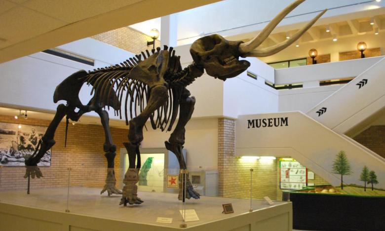
Exhibits from all major phases of prehistoric culture on Crowley’s Ridge and in the Delta region are located at the Arkansas State University Museum. There are also good collections of artifacts at various county museums.
Historic qualities
The first documented settlement of the ridge is credited to Benjamin Crowley, a veteran of the War of 1812 who later settled in Greene County. The ridge was the only suitable location for settlement throughout the 19th century, as the majority of the region was still a vast swamp most of the year.
The only way to get through the swampy flatlands of Eastern Arkansas was to follow a North-South route down the ridge. Over the years, this route was known by various names, reflecting its major uses at the time: the Buffalo Trail, the Indian Trail, the Chalk Bluff to Helena Postal Road, and the Military Trail.
Towns grew up along this route, and even lowlanders came to the ridge to bury their dead on the high ground. Each of the eight counties straddling the ridge also placed their seats of government on this steep rise to ensure year-round accessibility. These include Piggott in Clay County, Paragould in Greene County, Jonesboro in Craighead County, Harrisburg in Poinsett County, Wynne in Cross County, Forrest City in St. Francis County, Marianna in Lee County, and Helena in Phillips County.
Cultural qualities
One of the most noted aspects of culture on the ridge is music, with the Delta Cultural Center in Helena providing a rich history of the blues tradition in the region. The annual fall King Biscuit Blues Festival in Helena attracts thousands of fans from around the world.

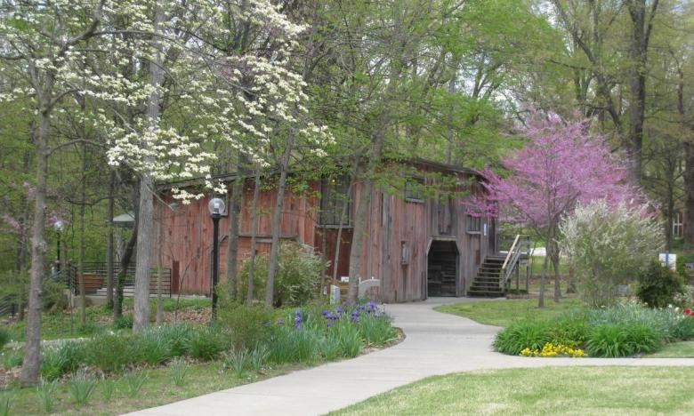
Literature of the 1930s is represented on the ridge through the Hemingway-Pfeiffer Museum and Educational Center in Piggott, which includes the restored barn-studio where Ernest Hemingway wrote portions of A Farewell to Arms and various short stories. Next door is the associated Matilda and Karl Pfeiffer Museum and Educational Center.
Arkansas State University is home to the ASU Museum, the Bradbury Art Museum the Fowler Center for performing arts, and the First National Bank Arena. The Collins Theatre in Paragould, The Foundation of Arts/Forum in Jonesboro, the East Arkansas Community College Fine Arts Center in Forrest City, and the Phillips Community College Fine Arts Center in Helena are also popular venues for entertainment.
In addition, most counties on the ridge celebrate their culture through small rural museums, and nearly every town has an annual festival. Folk crafts and folk art also abound on the ridge. These include woodworking, quilting, yard art, mailbox decoration, tie-hacking, fishnet making, duck decoys, and folk toys.
Recreational qualities
Large and small cities, rural communities, agricultural lands, highlands, river bottoms, wetlands, five state parks, and the St. Francis National Forest all lend themselves to diverse recreational opportunities along the corridor. You’ll find ample opportunities for sporting events, golf, hunting, fishing, swimming, camping, picnicking, hiking, biking, horseback riding, watchable wildlife, and photography.

Scenic qualities
Crowley's Ridge provides the most dramatic and beautiful scenery in eastern Arkansas, due to the uniqueness of the topography and the variety of floral species. The route is especially dramatic in the fall, when changing leaf colors in old growth forests are spectacular. In the spring, the ridge comes alive with dogwood, peach and apple blossoms, and wildflowers.
Much of its scenic beauty results from the pastoral vistas. Along the route, one finds small farmsteads, rolling pastures, and livestock. Typical are old wooden barns; rural churches and cemeteries in peaceful settings; country stores; orchards in full bloom; quaint springs; and colorful meadows.
.jpg?itok=dV7Jk4LD)